Monday, May 23, 2005

Clouds, wind, and....

When I got to the airport this morning, I was a bit slow to get started with the preflight. I farted around with this and that, not really accomplishing much. The wind was gusting, sometimes to 20 knots or so according to the windsock which occasionally stood straight out. I had a tough time determining if I was actually GOING to fly, but proceeded as if I were. I fueled, did a preflight, put a little grease on the propshaft pillow block bearing bolts because they were starting to rust. The grease was probably just as unsightly as the rust, but at least I would be able to get the nuts off the screws next time I need to change drive belts. The wind died down a bit, at least for a while, so I decided to fly.

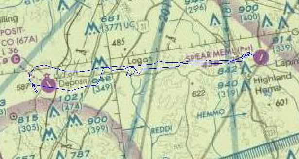
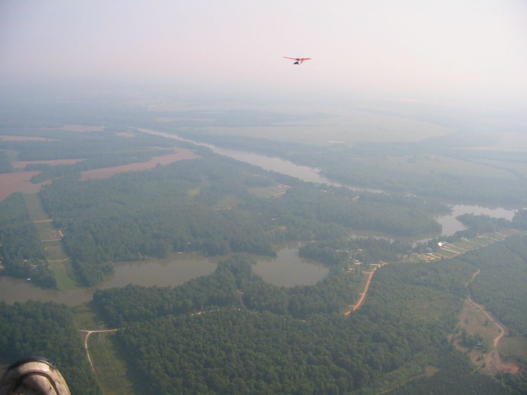
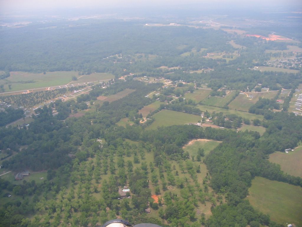
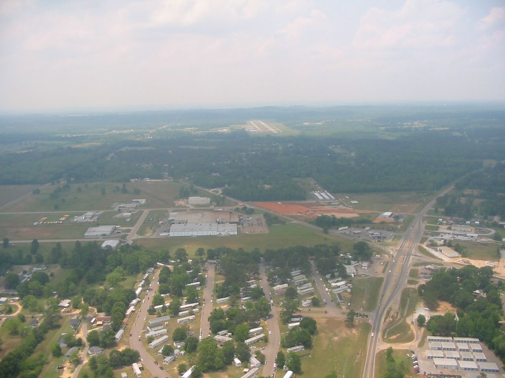
My intended destination this morning was a private airstrip, Spear Memorial in Lapine, Alabama. I've flown to this strip once before near the end of 2004. I was a bit bummed because I forgot to bring the CF card for my camera so I wasn't going to be able to take pictures. The GPS said the airport was about 18 miles pretty much due east, which sounded about right. I took off on runway 33 and headed around Ft. Deposit to the north before heading east. It was moderately bumpy and there was about 40-50 percent cloud cover with breaks at regular intervals. At 1500 feet it was still pretty bumpy so I decided to try a bit higher. As I climbed, it appeared that I was getting closer to the clouds than the 500 feet minimum. I would estimate that the clouds were at 2200 or so as I climbed past 1800. I really wanted to see if the air was smoother above the clouds, but I have never really flown above the cloud layer and was a bit apprehensive. Due to my marginal climb performance, it was harder than I thought to be able to go through one of the larger breaks quick enough to keep from being engulfed by a cloud. To make matters worse, the closer I got to the clouds, the bumpier it became. I chickened out and decided to stay below the cloud layer at about 1700 feet. I would have liked more altitude due to the non-abundance of clear fields to land in, but there were enough where I didn't feel too uncomfortable.

My GPS seemed to malfunction a time or two. During my ascent and descent trying to get above the clouds, the Altitude reading seemed to stay exactly the same for maybe a minute, even though I knew I wasn't holding. Then it would read again, but with a big difference from where it was stuck. I also noticed as I got closer to the airport, the distance to the straight line course to my destination seemed to be off somewhat, maybe a few hundred yards or so. This observation was verified when I visually spotted the airport. I circled the small, paved strip looking for the windsock and signs of people or activity. Finding neither, I passed over mid-field and set up my approach. As I was approaching the strip, the wind was wildly blowing the trees in front of me. I navigated a couple of bumps on my way to the ground, but the landing wasn't as bad as I was expecting. The GPS was still reading that I was 1/2 mile from the airstrip. A half mile isn't that bad, but coupled with the altitude reading, I was starting to wonder what was going on with my trusted navigational aid.

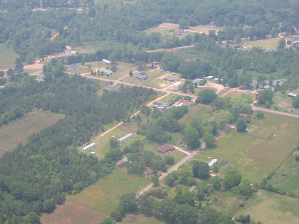
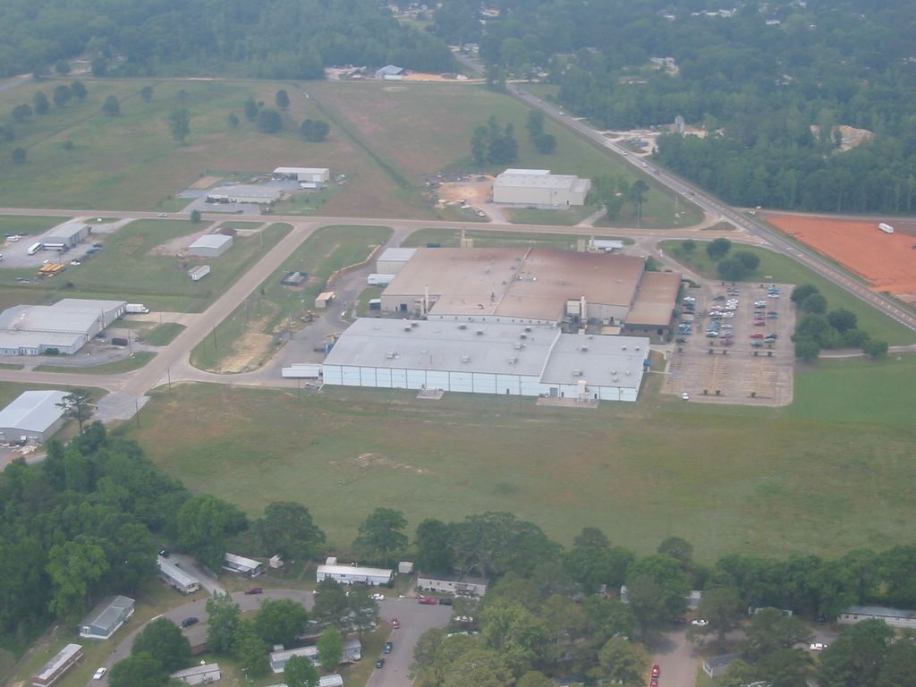
I circled the tarmac, approaching the big, arched, open ended hanger. Last time I was here there was a Tri-Pacer, a Cherokee, and a big Aero-Commander Shrike twin in the hanger. I was wondering how the twin got in. Strip is only 2900 feet long and really narrow, probably 25-30 feet wide. Today, only the Tri-Pacer and the Cherokee were there, as well as a couple of dogs and a cat. No people whatsoever. I didn't even shut off my engine. I taxied out and took back off, circling above some fields near the end of the strip as I gained altitude. The trip back was uneventful, but with a good tailwind. My groundspeed was 45-50 MPH. I arrived at the airport, checked the windsock and flew the pattern in preparation for landing. Lots of things going on with the wind in the trees at the runway numbers. I was being tossed about pretty well. I kept a bit of power on as I worked the rudder and elevator hard trying to stay centered on the runway. I even had to add some spoiler action to keep the wings level when I got close to the pavement. This was probably the most difficult landing I had ever made, but I touched down on the pavement and as all my flying speed was gone, it happened...

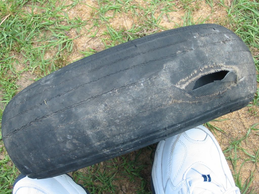
I heard a big pop and I looked down at my right tire to see it was going flat quickly. I pushed the left pedal to counteract and I found that I could keep the nose pointed down the runway. I carefully taxied on the flat tire, watching to make sure that my plastic rim wasn't getting closer to the runway where it would be abraded to shreds. I made it back to the hangar and worked like hell to pull the plane back in the bay. I was very thankful that the flat didn't happen while I was at the other strip and I was also happy that there were no major mishaps on the landing due to the flat. I suppose it would be a good idea to look at tires on the preflight, but I never have paid much attention to their condition. I guess I will now!


Path of my flight to Spear Memorial Airstrip in Lapine, Alabama. Posted by Hello


Blowout damage. Posted by Hello

Monday, May 16, 2005

The Wetumpka Fly-in

This weekend marked another first for me. I flew to my first fly-in. It was an EAA sponsored event at the Wetumpka, Alabama (08A) airport. Wetumpka airport is about 12 miles straight-line distance from Prattville airport (1A9) which I have visited only once before in my MX. My home base at Fort Deposit (67A) is about 40 miles from Prattville, so we are talking about a 52 mile one-way trip, which is about as far as I've ever flown in one day.

I previously had dropped off a five gallon container of pre-mixed fuel at a strategic place at the Prattville airport so that I could refuel enroute without having to buy 100LL aviation fuel. My friend Don wasn't going to be able to make the trip, but at the last minute his schedule opened up. When I arrived at Fort Deposit about 7:30 AM, he was already there washing his airplane...a Quicksilver Sport II. We briefly went over our planned route and after a thorough preflight inspection and topping off with fuel, we took off for Prattville.

The morning air was crisp and smooth. I can't remember the last time that I flew in such wonderfully smooth air. To make things even nicer, we had a bit of a tailwind. My GPS was reading right around 50 MPH groundspeed. These conditions lasted all the way to Prattville, where we landed without any hitches.

I topped off my fuel, visited the bathroom, and chatted for a bit with one of the FBO owners. After Don and I talked about the next leg a bit, I requested that we go to the north of the City of Prattville so that we could keep far away from the Class D airspace of Maxwell Air Force Base. Technically, there is just a very small corridor that would allow us to pass to the south legally, but I've seen too may C-130s come zooming off the end of the AFB runway at 300 MPH. They usually fly right where we would be flying if we chose to go south of Prattville. We started up, strapped in and headed for Wetumpka.

I only live 5 miles from the Wetumpka airport, even though I drive 45+ miles to Fort Deposit to fly my airplane. I was badly wanting to fly over my house and get some pictures, but I was already a bit nervous because the ground we were flying over was becoming increasingly populated with buildings. It was very interesting flying over areas that I knew so well and seeing buildings from the air that I was very familiar with. I was so concerned about flying over congested areas that I was oblivious to most things on the ground, but I followed Don who used to fly out of Wetumpka on a frequent basis.

When we were about 3-4 miles from the Wetumpka airport, There was an announcement that a group of four Yak 52's were taxiing for takeoff on the runway perpendicular to the one that Don and I were intending to use. I announced our position and intentions immediately afterward but received no acknowledgement. I could clearly see the first pair when it took off as were only about 2 miles out. They made a left turn some distance from the end of the runway, and were heading toward Don as the second two Yaks took to the air. When Don noticed the first two, he started a rapid descent to stay out of the way. As he did, the leader of the flight advised of some ultralight traffic as he passed directly over Don about 500 feet higher. The second two Yaks were closer to me, but also passed safely overhead as I was heading lower. We continued to land without any incidence.

As I was taxiing to the parking space a traffic official was directing me. As I parked, I killed my engine and took off my headset. The official was wearing a radio, so I asked if he had heard me announce. He told me that he had heard, but everything was so busy that he was about to request Air Traffic Control assistance! Obviously, he was joking, but he made his point and I told him that I understood his frustration. A few minutes later after I had extracted myself from the plane, I went over to Don and asked if he had heard the Yak's announcement. He said he didn't, then I asked if he heard my announcement, and he said he did not. He asked me if I had heard other traffic conversations from Prattville which was on the same frequency as Wetumpka. I had heard some, but not all of what he was referring to. This was all very strange to me, but I was content knowing that somebody on the ground had heard me!

We stayed at the fly-in for about 3 hours. Drank some beverages, ate some food, answered questions from drive-in visitors and watched the wind steadily increase the whole time. Don had seen predictions that the winds were supposed to lessen shortly after noon, and they seemed to die down a bit. We decided to leave about 1:00 or so. As we were taxiing for takeoff, the wind gust were causing the sock to stick straight out! After waiting for a Cessna 195 to take off before us on runway 18 and waiting again for a Piper Cherokee to take off on runway 27 and clear runway 18, I announced and took off. We were going to go back to the south of Prattville this time because there didn't appear to be any traffic out of Maxwell on this particular day, but first, I was going to fly over my house and take some pictures.

The wind was terrible and constant corrections were required to keep the plane upright in the desired direction. Because of this, I didn't fly as low over my house as I wanted. I was still about 1000 feet above my house as I snapped a few shots. I then led Don to the south of Prattville, keeping a sharp eye watching the runways at Maxwell AFB which were very visible and unmistakable! I flew near the roads that I drive on a daily basis making my way towards Prattville. I took a few pictures of many of the landmarks so that I can post them. Near the Prattville airport, Don took the lead and I followed him as he flew his approach. Landing was a bit tricky because of the wind and the thermals, but we both made it down safely, even if the landings didn't look pretty!

I refueled in short order, and we were back in the air quickly, headed for Fort Deposit. Until we got within 5 miles of the Fort Deposit airport, things were non-eventful. A few miles previous, I decided to fly a bit lower than Don. The thermals kept taking us closer and closer to the clouds and I was tired of the bumps. I descended to about 1800 feet and continued on toward the airport. I figured Don was following me, but I couldn't see him above me. As we got closer to the airport, I started to look for him. I did a gentle 360 degree circle and I didn't see him. I then did another, tighter 360 and still didn't see him. Since I had plenty of fuel, I decided to back-track the route using my GPS so that I might find Don. Before I had gone a mile, I see Don in the distance to the east of me. I found out later that he had been doing circles looking for me also! We tracked on to the airport where Don landed first. I watched and took pictures at 1000 feet before setting up for my landing. As I was on the downwind leg, Don came on the radio and told me to keep my speed up on landing as there were some crazy wind currents on the approach. I kept my speed up, but kept shoving the stick forward because the thermals were trying to keep me in the air. The landing wasn't too bad considering and I was glad to be home and on the ground.

We had been in the air about 3.2 hours and had flown 105 miles, just short of the Evergreen trip by about 1 mile!


GPS track showing the route taken to get to the fly-in. The left (west) track and the one that goes around Prattville to the north is the path flown when arriving at Wetumpka.  Posted by Hello


First time I've ever been in a newspaper article! Posted by Hello


The first pic of the flight. The goldenrod is starting to flower in the pasture. Posted by Hello


Very hazy as we climb to 1800 feet about 15 minutes after departure from Fort Deposit. Posted by Hello


A beautiful, expensive, exclusive home in the middle of nowhere. Right where I would want to be! Posted by Hello


Talk about $$$$! Posted by Hello


I'm just about to fly over Catoma Creek, then the Alabama river on our way to Prattville. Posted by Hello


Historic downtown Prattville. The large buildings to the lower right of the pond are the Continental Cotton Gin manufacturing complex, one of the oldest manufacturing facilities still functioning in the US. Posted by Hello


Standing just in front of my MX looking east along the taxiway. Posted by Hello


Standing just in front of my MX (see the wingtip) looking west along the taxiway. Posted by Hello


Taxiway 9/27 looking toward the west at Wetumpka airport. That's a Yak 52. Posted by Hello


View from just in front of the food tent looking toward the west along the 27 taxiway. Notice the nose of the same SNJ that I posted pictures of a while back.  Posted by Hello

A Pietenpol Air Camper. Posted by Hello


A Kolb 2-place. Posted by Hello


Somewhere near the middle of this shot is my home. It has a bunch of cars in the yard. Posted by Hello


A bit closer. Posted by Hello


This is as close as I could get. The ones taken directly overhead through the frame of the plane were blurry. Afterall I was trying to fly and deal with wind gusts and thermals while trying to take pictures! Posted by Hello


The new Racetrack gas station between the red clay bare places. Cheapest gas in town. Posted by Hello


Looking west toward downtown Prattville. This is the major retail area of the city. Posted by Hello


The Robert Trent Jones golf trail course in Prattville. The lake (pond, slew, ect.) is called Cooter's Pond. It has an access point (boat launch) to the Alabama river. Posted by Hello


A sub-division in Prattville. The church in the middle is for sale if anybody is interested! Posted by Hello


My place of work, Haldex Friction Products in the center with the Prattville airport clearly seen in the background. Posted by Hello


Still closer... Posted by Hello